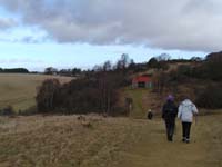
This section is 10 miles / 16 Km consisting of a combination of quiet
minor roads, moorland track and riverside walks. This passes by the
ancestral home of Sir Walter Scott.
Starting in the Market
Square head up Kirk Wynd by the side of the Post
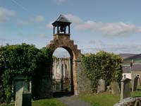
Office. On the right is the Auld Kirk and the site of the "Kirk 'o'
the Forest". It is said that in this Kirk in 1297 William Wallace was
named Guardian of Scotland. Continuing past the ruin the Way climbs up
through housing to meet the A7 trunk road. Cross the road and using
the pavement on the left start along the A699 road to St Boswells. At
the first bend the walking route turn off the road on the left and
proceeds alongside the golf course.
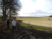
The path remains by the golf course as it extends into Selkirk Common.
Once the golf course has parted from the walk there is a short section
before the path turns to the left and then out onto a track at Buxton.
At this stile turn right and descend down to the Dean Burn. At this
corner there was once a fewer hospital, but now no signs of its
existence remains.
An initially gradual climb along a track bring the Way past the side of
Bell Hill and up towards a farm at Greenhead but instead of having to
pass through the farm yard the route turns off the track and round the
edge of two fields before reaching the minor road at Shawmount. Just
before exiting at Shawmount there are panoramic views back over Selkirk
and into the Ettrick Valley, and it is a good point to take a first
break and catch your breath.
Now on the road there is a continual incline as the route makes its way
towards Lindean Moor and Halfcrown Corner. On the left and below in
the valley is the little community of Lindean. It was in this community
location that Selkirk Abbey was build in the early 12th century, but
it did not remain for long and the Monks chose to re-establish
themselves in more fertile lands at Kelso. On the right is the Lindean
Mast beaming television signals to the Central Borders' community. To
the side of the mast on the roadway there are more attractive views,
now opening up the countryside to the north and northeast. To the west
the views are up the Yair Valley and towards the Tweeddale hills.
Close to the summit of this road the Way turns to the left and passes
down a track and then narrow path to then intersect with another road
coming up from Lindean to Half Crown Corner. Cross the road and start
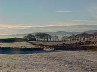
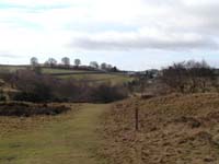
up an old drove road that makes its way towards Faldonside Moor. On the
way to the Moor the walk crosses several stiles, passes by Whitlaw
Kips and a panoramic viewing point with views to the north, west and
southwest. The track descends to a corner before a straight and gradual
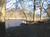
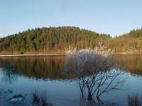
incline across Faldonside Moor to the side of Cauldshiels Loch.
Cauldshiels is a small but popular loch with the local population and
is used for fishing and general recreation. It is bounded on one side
by trees and is very secluded from the surrounding landscape. The route
touches on only a very short part of the loch's shore before turning
north and into the wood and out via a vehicle track. On this section
there is a high vantage point where for the first time there are views
down the valley toward Melrose and the Eildon Hills.
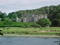
The route to Melrose could be much more direct but would lack a lot of
the interest that comes from following the Borders Abbeys Way route via
Abbotsford and the River Tweed. To enjoy this be sure to turn off the
Darnick to Upper Faldonside road and pass Abbotsmoss, then left again
at the next junction to eventually arrive down a wooded single track
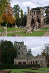
road* at a crossing adjacent to Abbotsford, the ancestral home of Sir
Walter Scott.
* There is now (since April 2018) an option to divert from the roadway and take a short waymarked woodland path
down to the west end of Abbotsford House then via a path within the estate reach the Abbotsford Visitor Centre.
For more information on this attractive alternative route link to the News Section.
If possible make time to visit the new visitor centre and this interesting house,
designed by Sir Walter Scott containing a wonderful collection of
books and armoury.
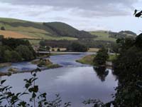
The route from Abbotsford is now by the side of the River Tweed and is
common for this section with the Sir Walter Scott Way. Follow the
track down the side of Abbotsford to close to the river, turning right
along a tree lines path toward a major road and modern bridge over the
Tweed. The path goes under the bridge decking then up the other side
and round a side of the Tweedbank community. With the river still on
the left and again close at hand the path passes under an arch of the
old railway line bridge, and then quickly back to the river bank. The
walk curves to the east passing by Lowood House before temporarily
leaving the banks of the river to come onto the Lowood House drive,
cross a public road at the "Bottle Bridge" and again regaining the
riverbank behind the Waverley Castle Hotel and Skirmish Hill.
With only about 2 kilometres to go the rest of the walk is on open and
pleasant pastures beside the Tweed with a final raised section at
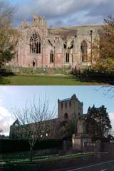
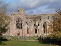
Melrose, back down to the Chain Bridge and then soon afterwards a right
turn up the Annay Road to the Abbey at Melrose. If you continue past
the Abbey you are into the Market Square and the centre in less then
200 metres.
To move to the next section of the Way click here.

 * There is now (since April 2018) an option to divert from the roadway and take a short waymarked woodland path
down to the west end of Abbotsford House then via a path within the estate reach the Abbotsford Visitor Centre.
* There is now (since April 2018) an option to divert from the roadway and take a short waymarked woodland path
down to the west end of Abbotsford House then via a path within the estate reach the Abbotsford Visitor Centre.